


Launched aboard GSLV-F16, NISAR was the first satellite that ISRO’s GSLV vehicle successfully placed into a Sun-synchronous Polar Orbit. This 18th flight of the GSLV—and the 12th using the indigenous cryogenic stage—demonstrates India’s growing technological maturity in space systems.
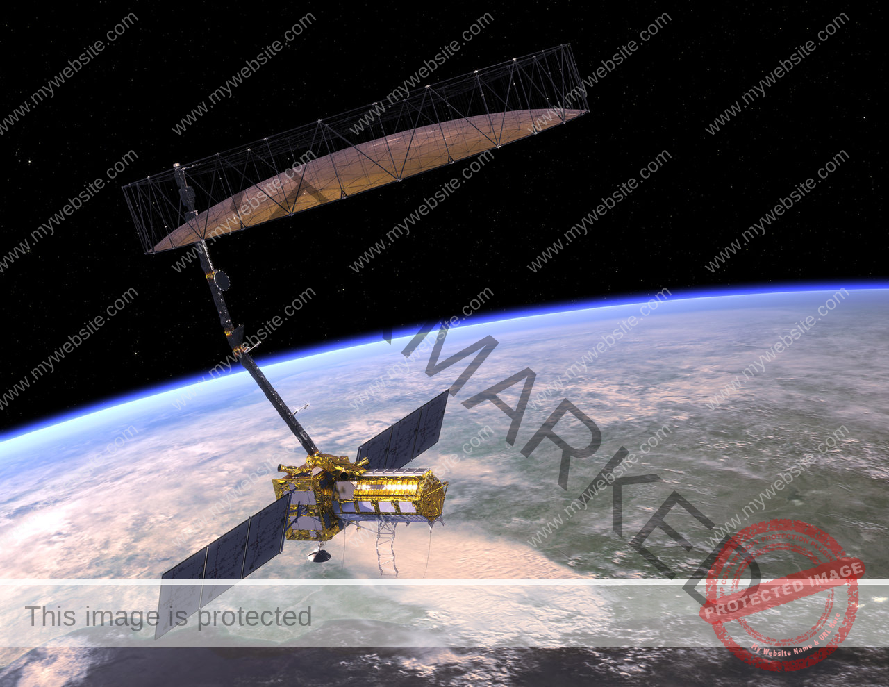
Jointly developed by NASA and ISRO, the NASA-ISRO Synthetic Aperture Radar (NISAR) is the world’s first Earth observation satellite to carry dual-frequency synthetic aperture radars—L-band by NASA and S-band by ISRO—on a single platform. It will deliver high-resolution, all-weather, day-and-night imagery of Earth’s land and ice surfaces, revisiting each location every 12 days.
While NISAR’s applications in disaster management, climate monitoring, glacier tracking, and agriculture are well documented, the satellite’s impact will extend far beyond.
The data from NISAR will serve as a backbone for smarter, science-driven decisions in shipping routes, air traffic systems, and even national infrastructure planning.
The 2,393-kg satellite was inserted into a 747-kilometre Sun-synchronous orbit. Over its five-year mission life, NISAR will offer invaluable data for global climate science, seismic and volcanic monitoring, forest mapping, and resource management. Dr. Jitendra Singh highlighted that the open-access policy for NISAR’s data will empower not only scientists and researchers, but also developing countries, disaster-response agencies, and climate change stakeholders worldwide.
Built around ISRO’s I-3K spacecraft bus, the NISAR satellite reflects deep cooperation between NASA and ISRO. NASA provided the L-band radar, GPS receiver, high-rate telecom system, Solid-State Recorder, and the 12-meter deployable antenna. ISRO contributed the S-band radar, the spacecraft bus, the GSLV-F16 launch vehicle, and associated systems and services. The mission, estimated to cost over $1.5 billion, is jointly funded by both agencies.


